AI Assistant
A conversational AI assistant for the entire geo workflow.
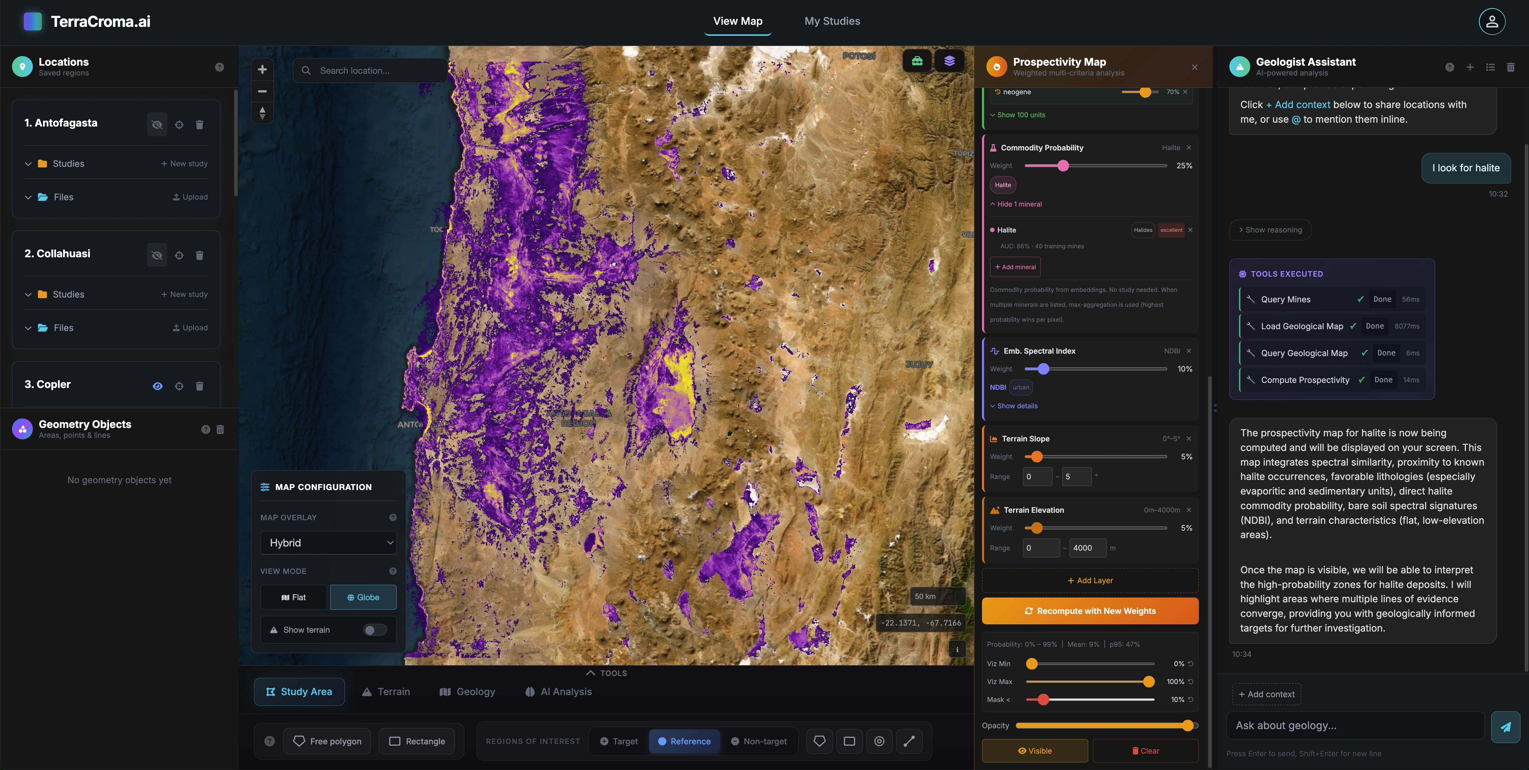
Knows every tool. Knows your data. Helps at every step. Describe what you want. "map iron oxide alteration around this district, find every fault within 5 km, rank the overlap", and the assistant picks the right tools, sequences them, and merges their outputs into a single answer.
Conversational analysis
Describe what you want to see. The assistant runs the workflow for you.
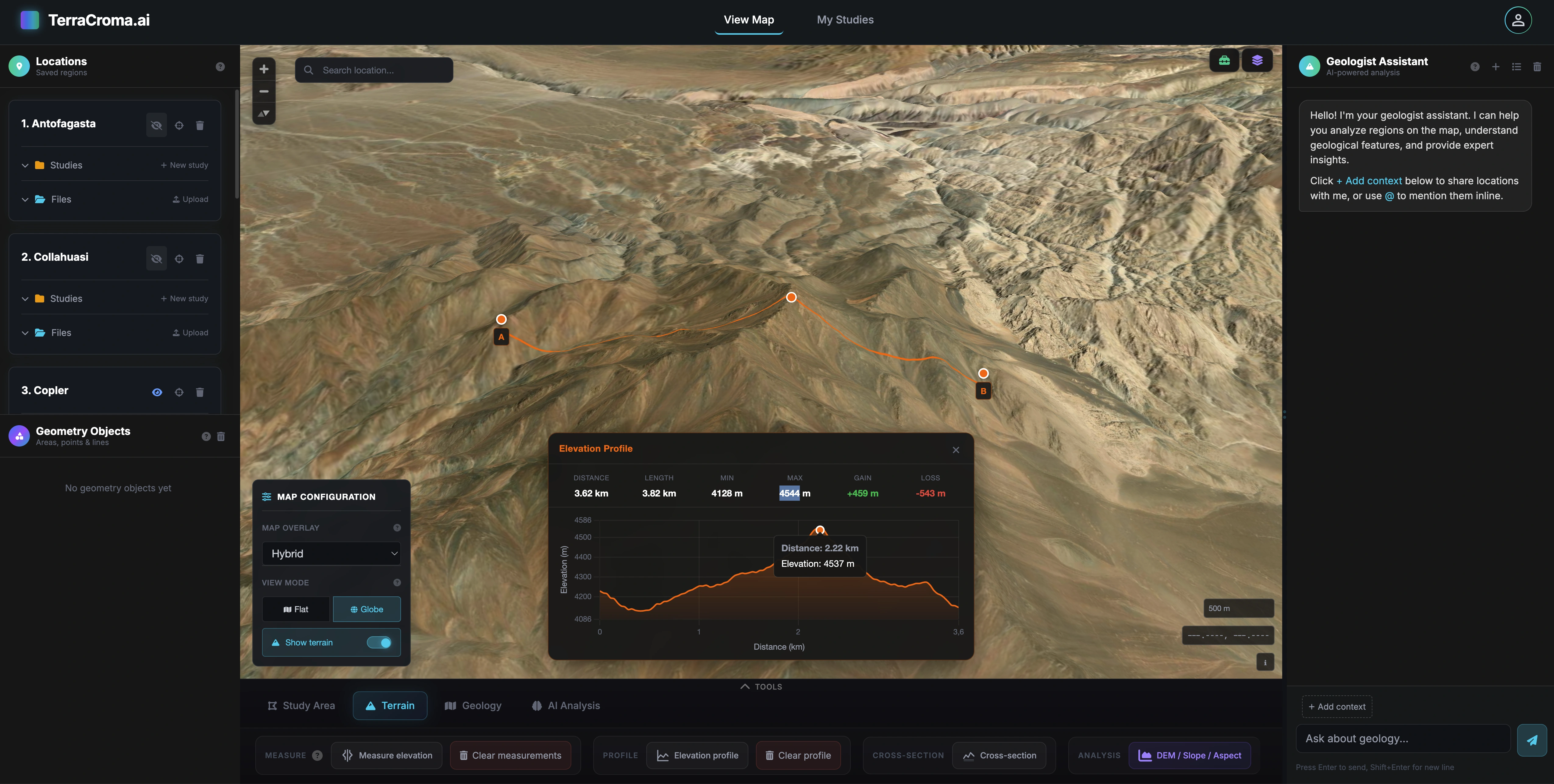
Multi-step reasoning
One conversation chains shapes, indices, deposit queries and report generation.
Bring your documents
Drop in drilling logs, field notes or geological sketches. They become part of the conversation.
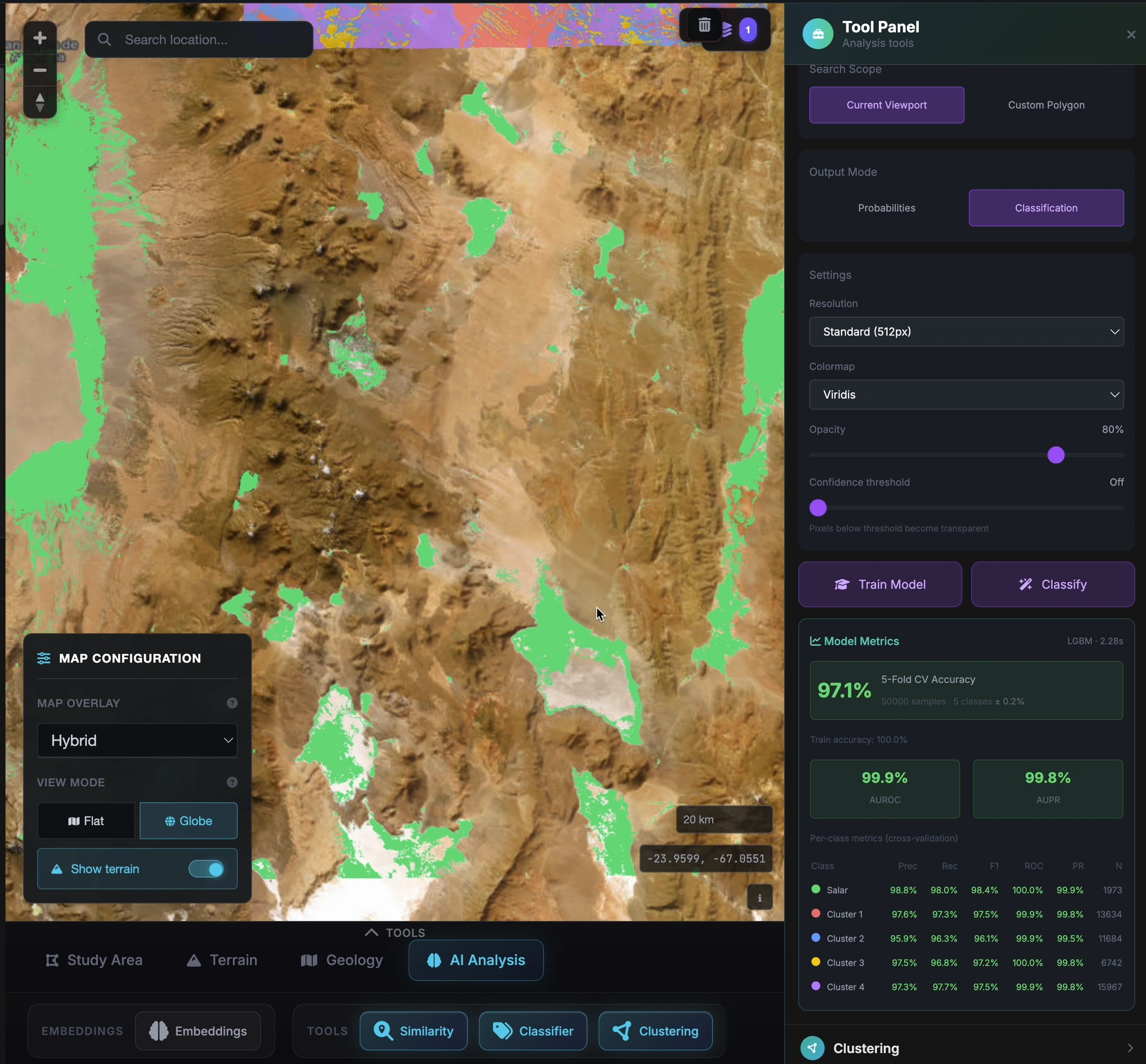
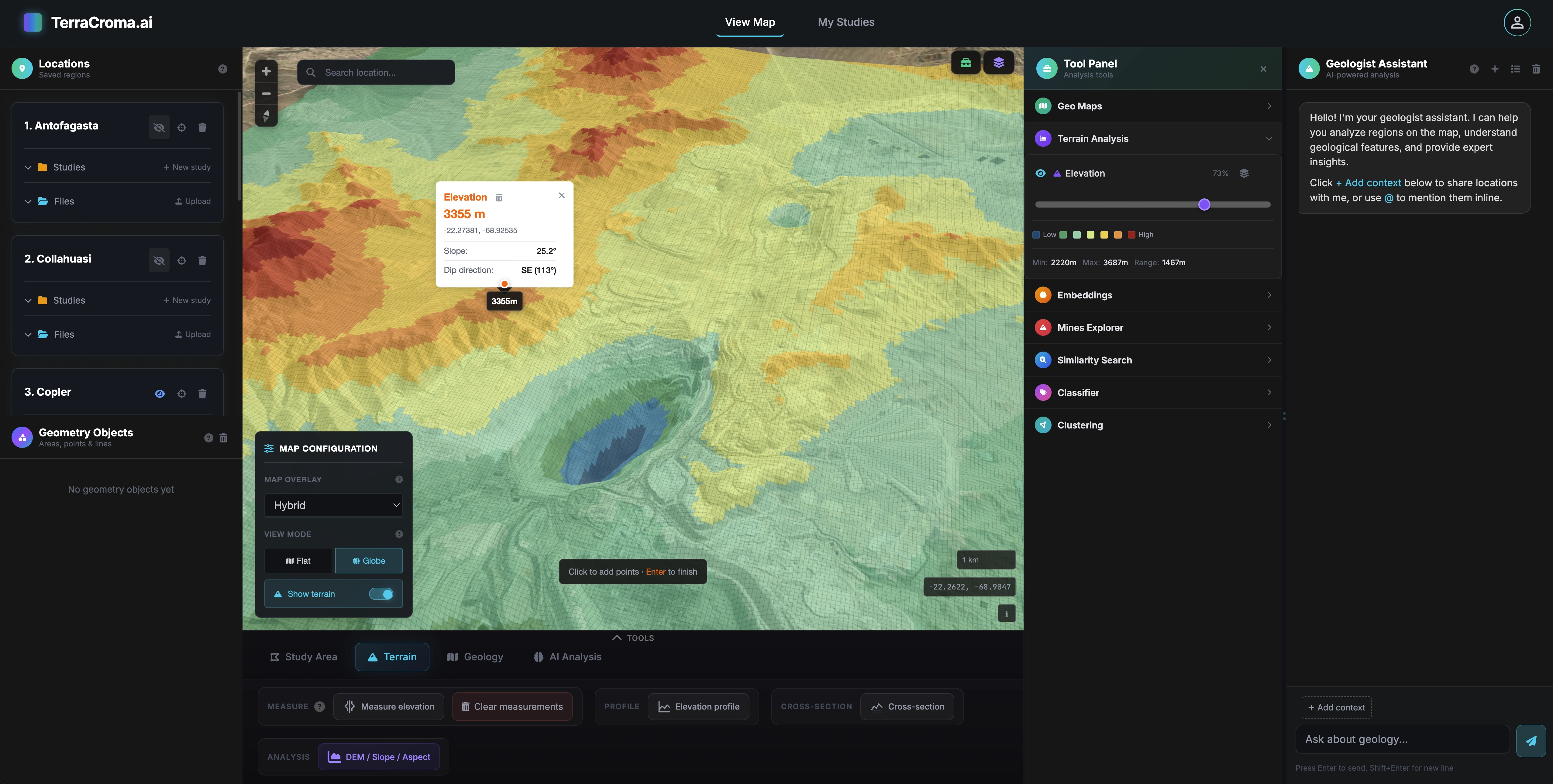
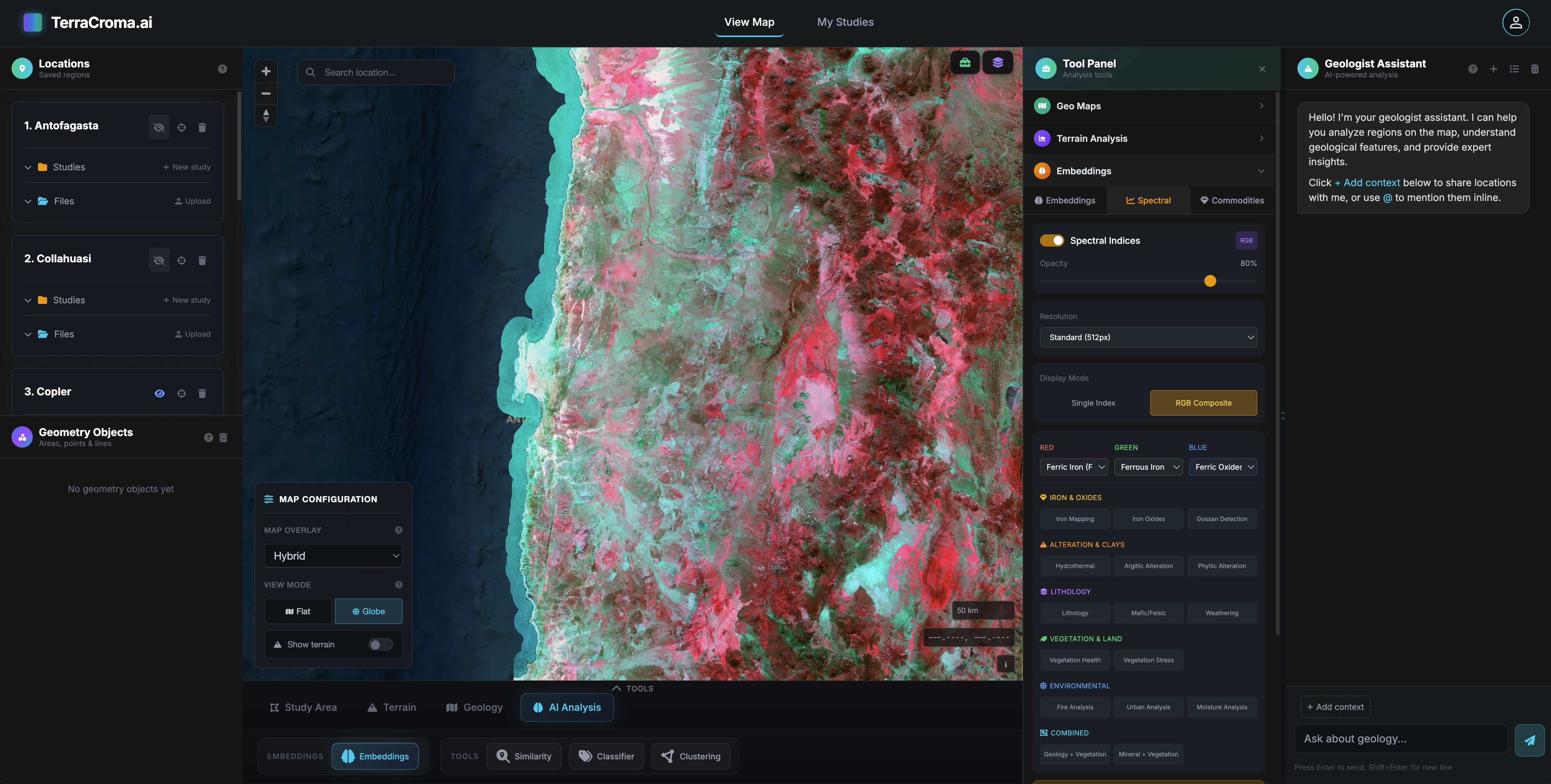
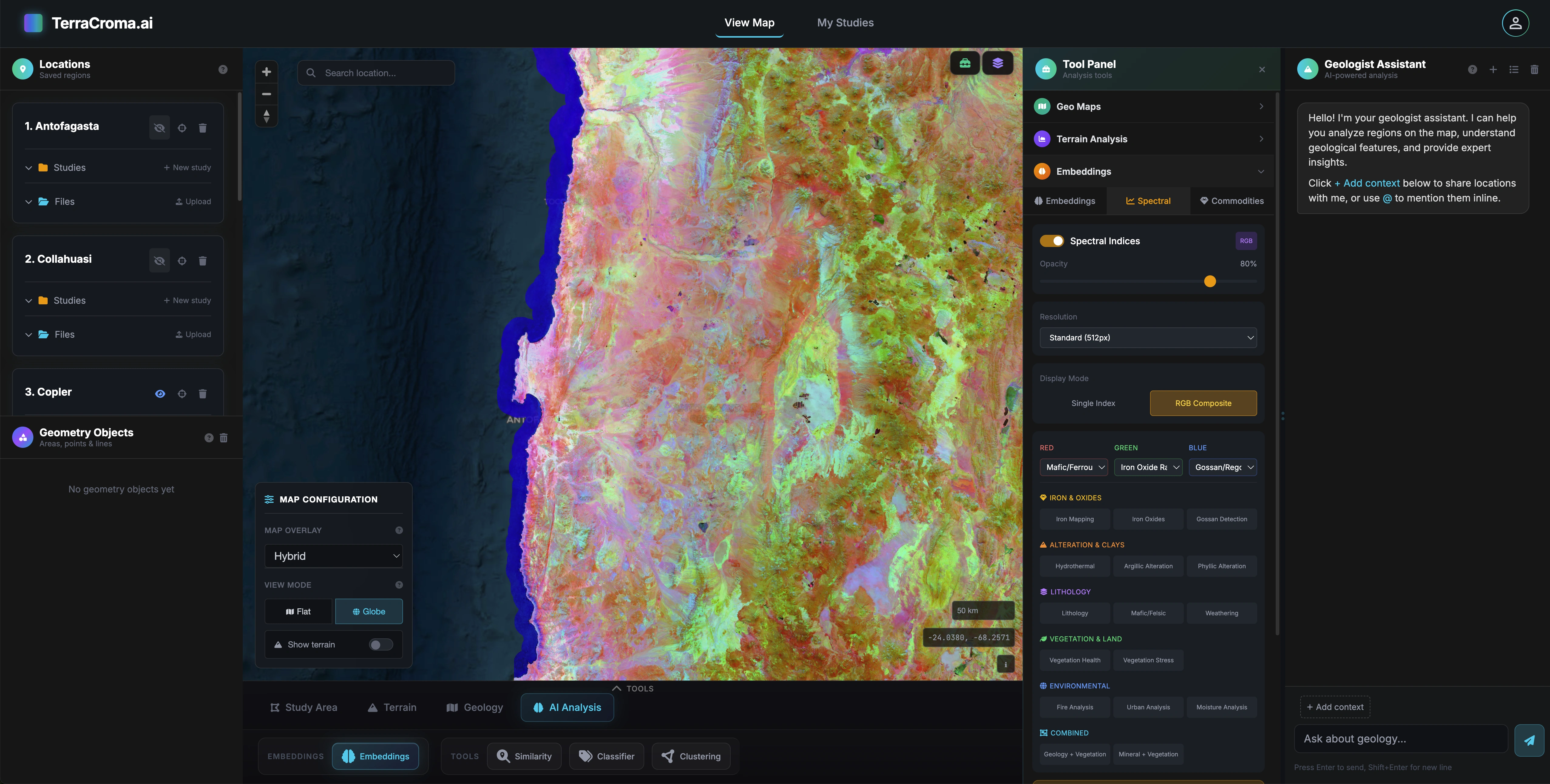
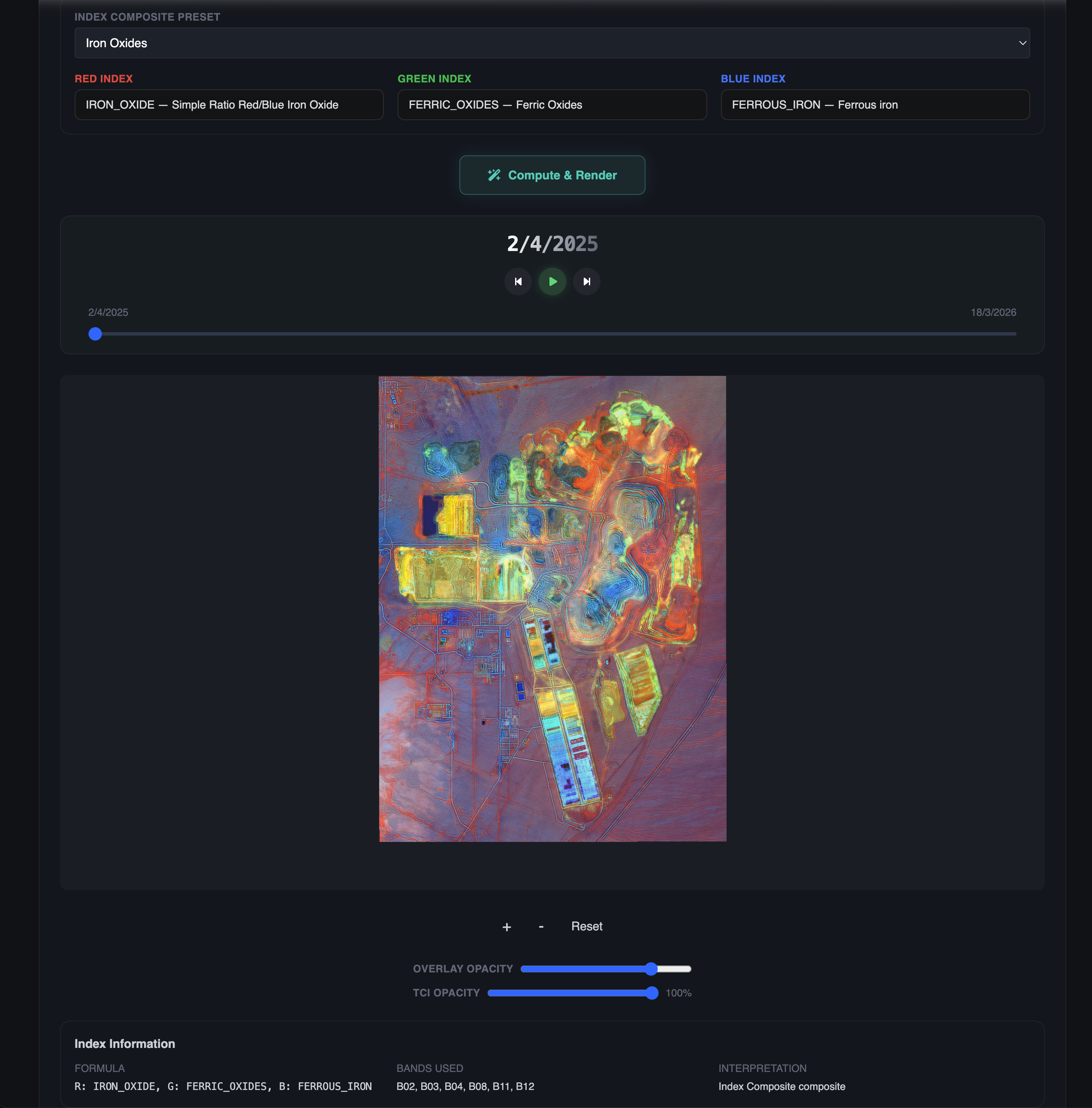
Tool orchestration, not chat
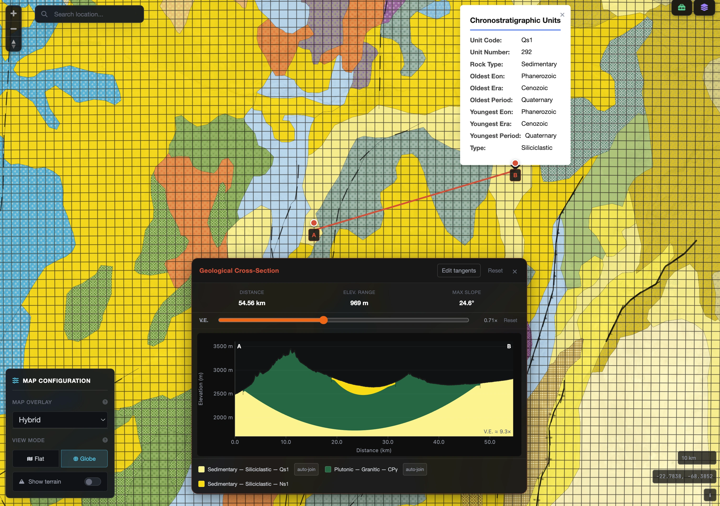
Spectral indices, geometry, prospectivity, deposit queries, cross-sections, map captures, chained into a single workflow from one prompt.
Persistent conversations
Every session is saved with full context: viewport, active study, layers loaded, so you can pick up exactly where you left off.
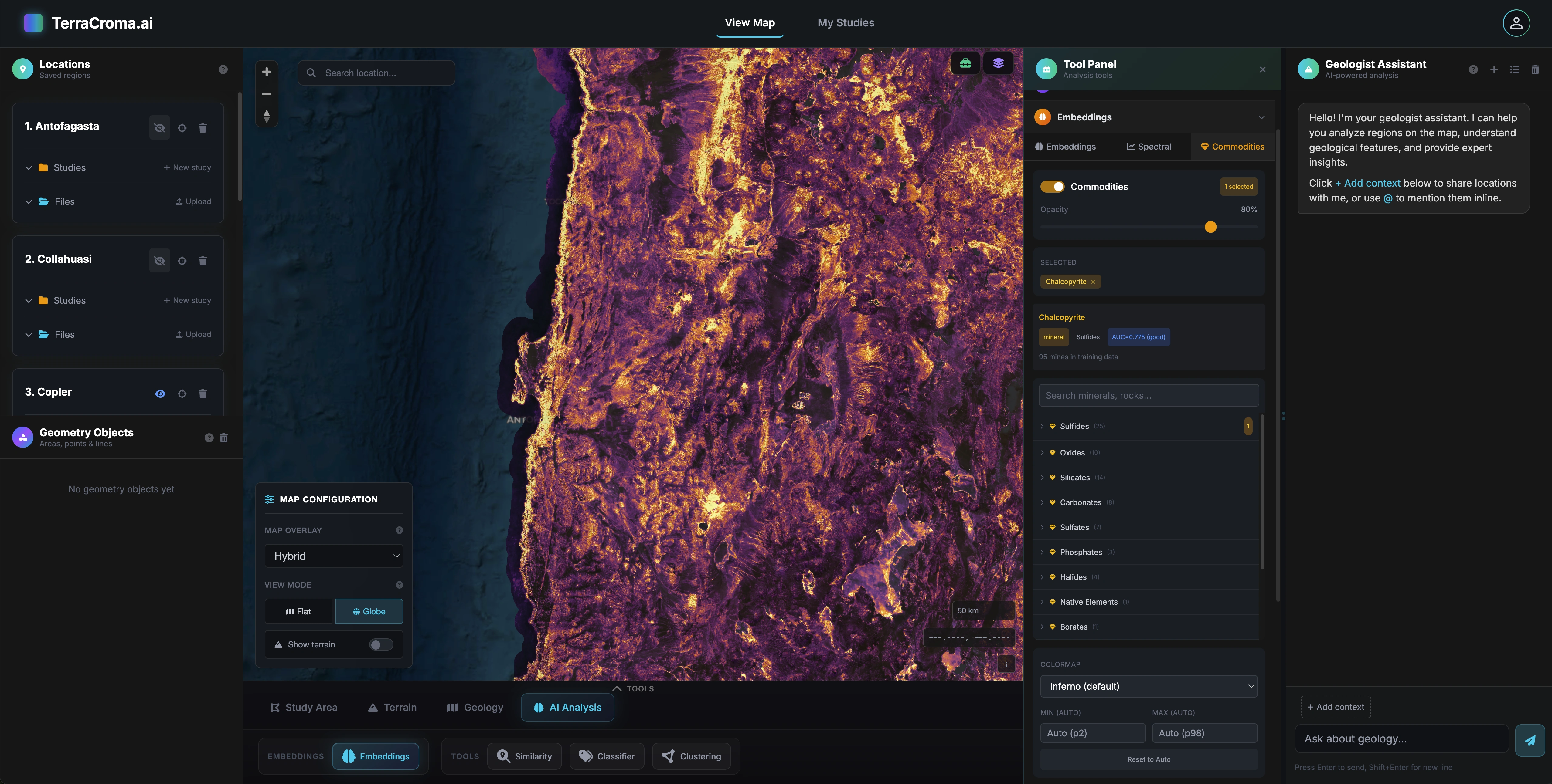
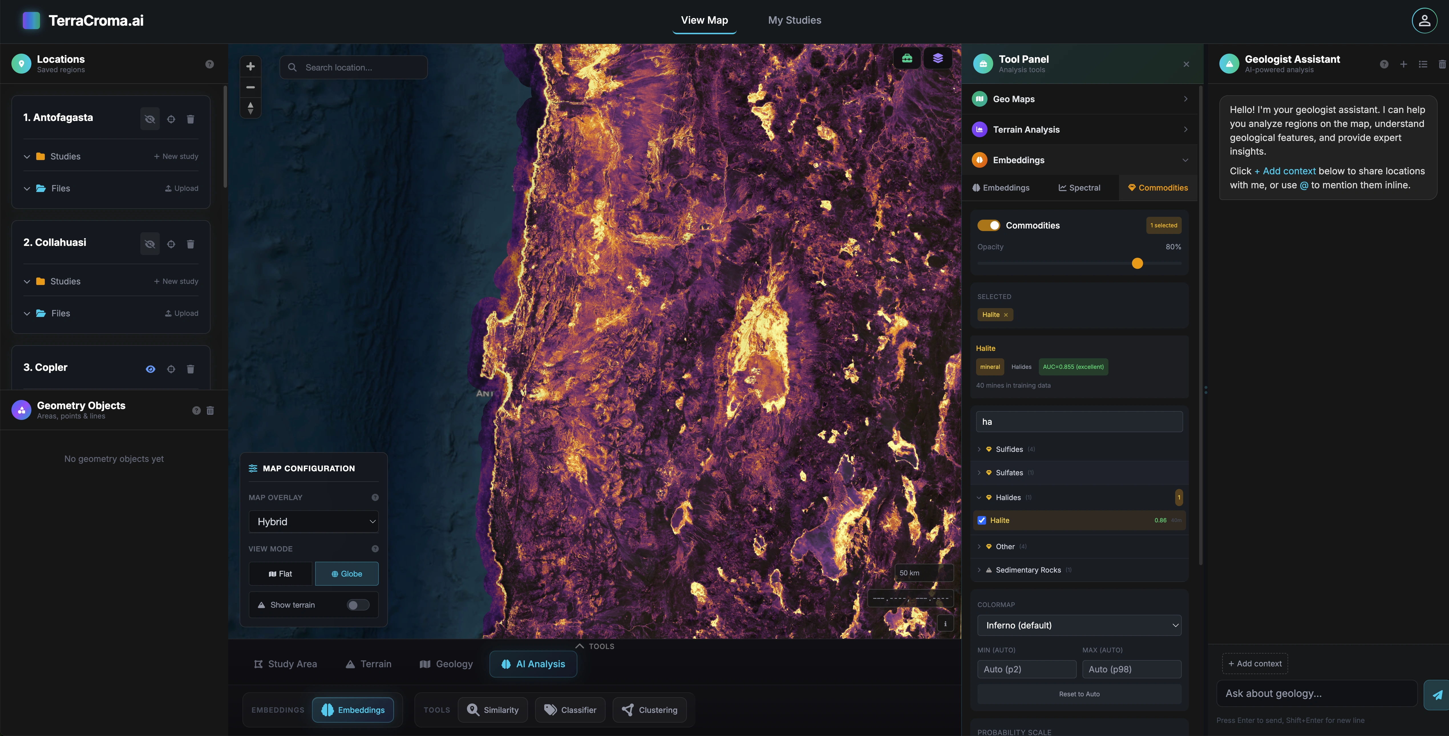
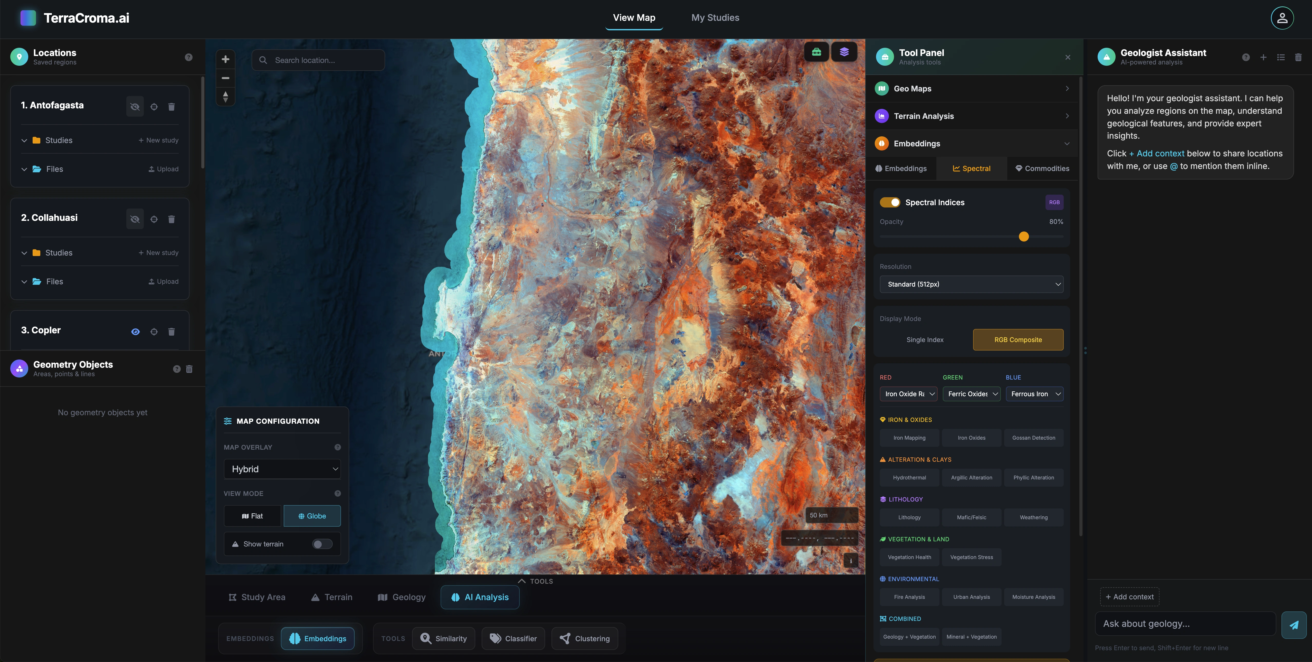
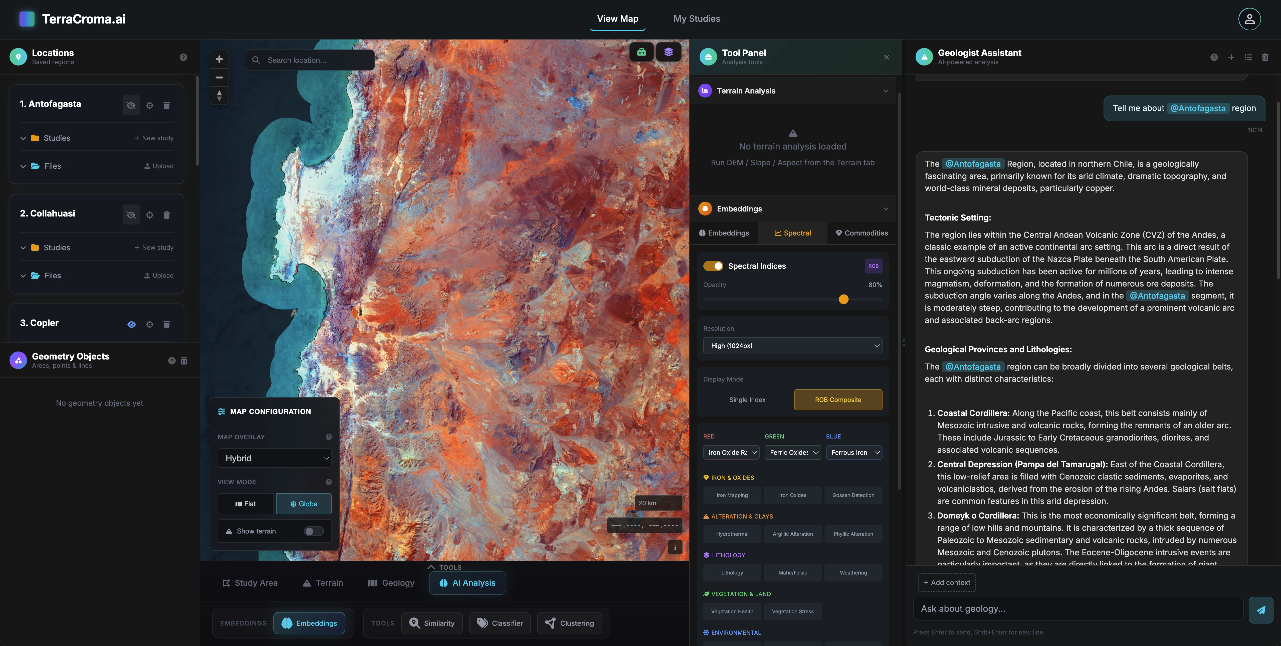
Multi-modal input
Drop in an outcrop photo, a drilling log or a geological sketch. The assistant reasons over imagery and text together.
Pluggable LLM backbone
Frontier models behind the scenes. Swap providers without changing the workflow.
Multi-step reasoning
From one instruction to a complete geospatial workflow.
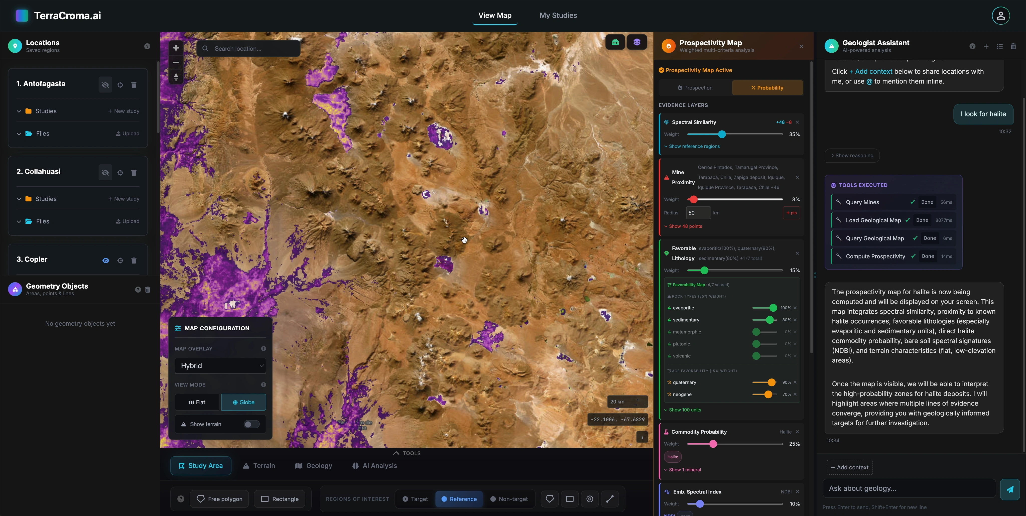
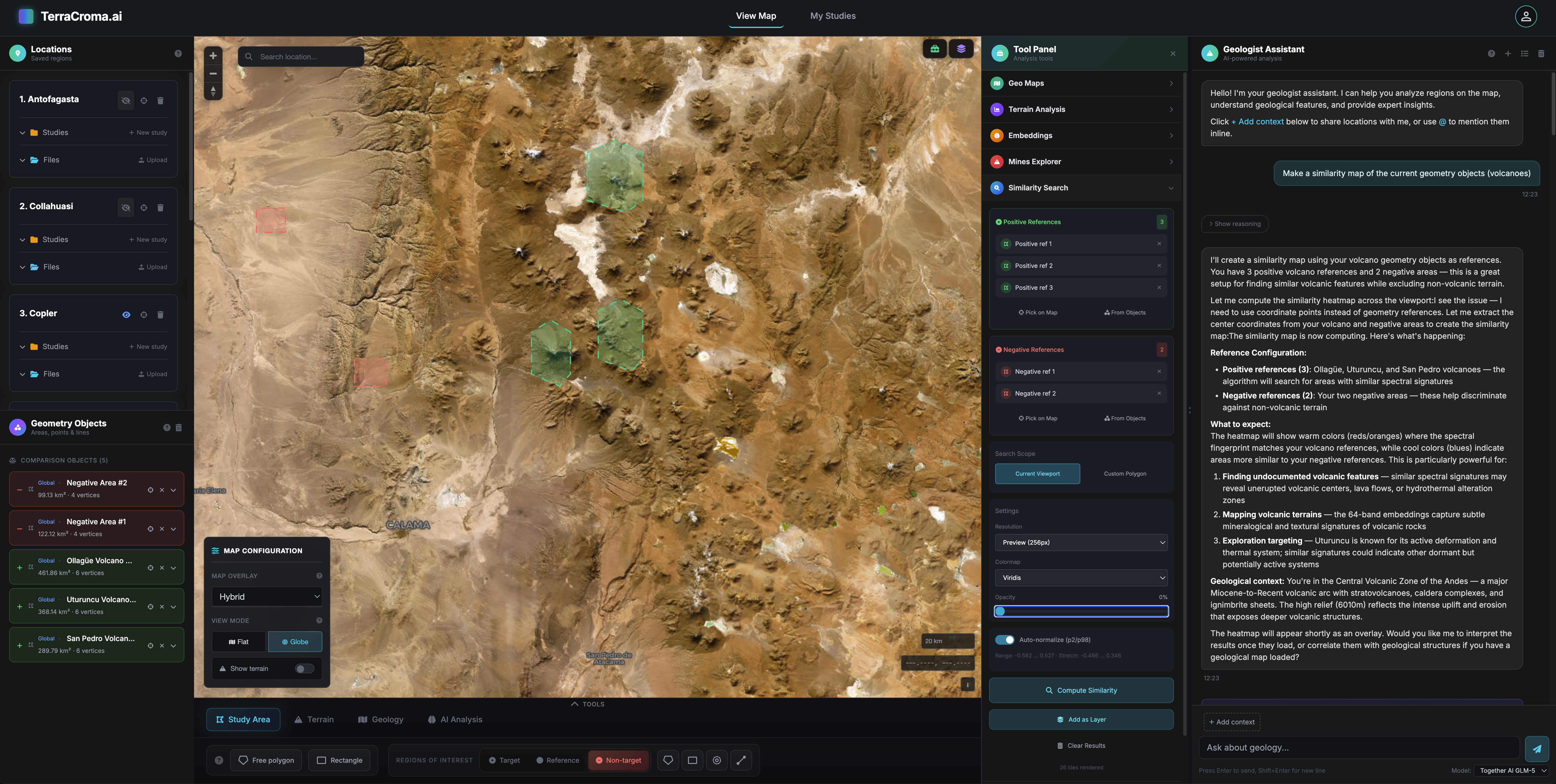
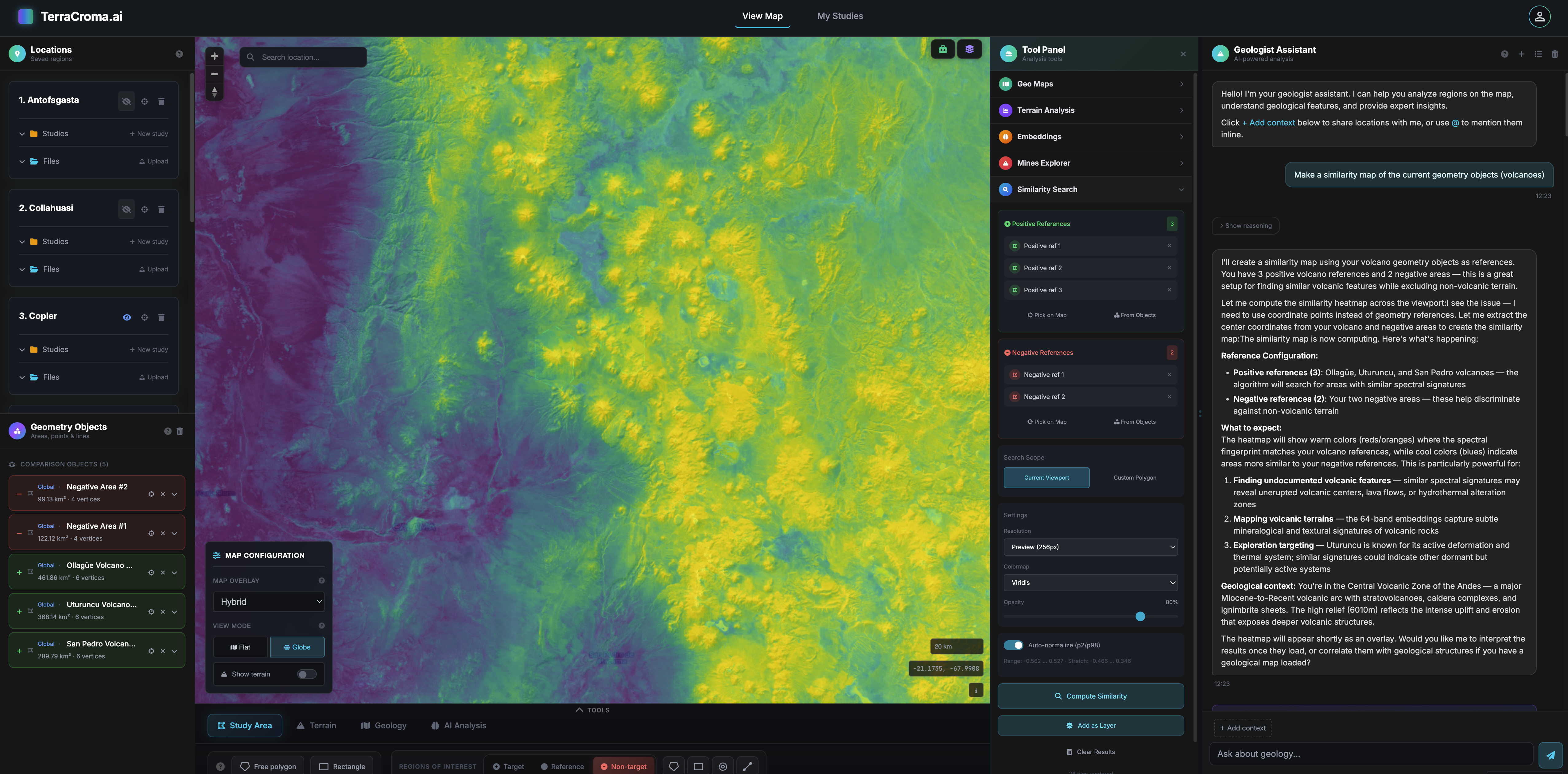
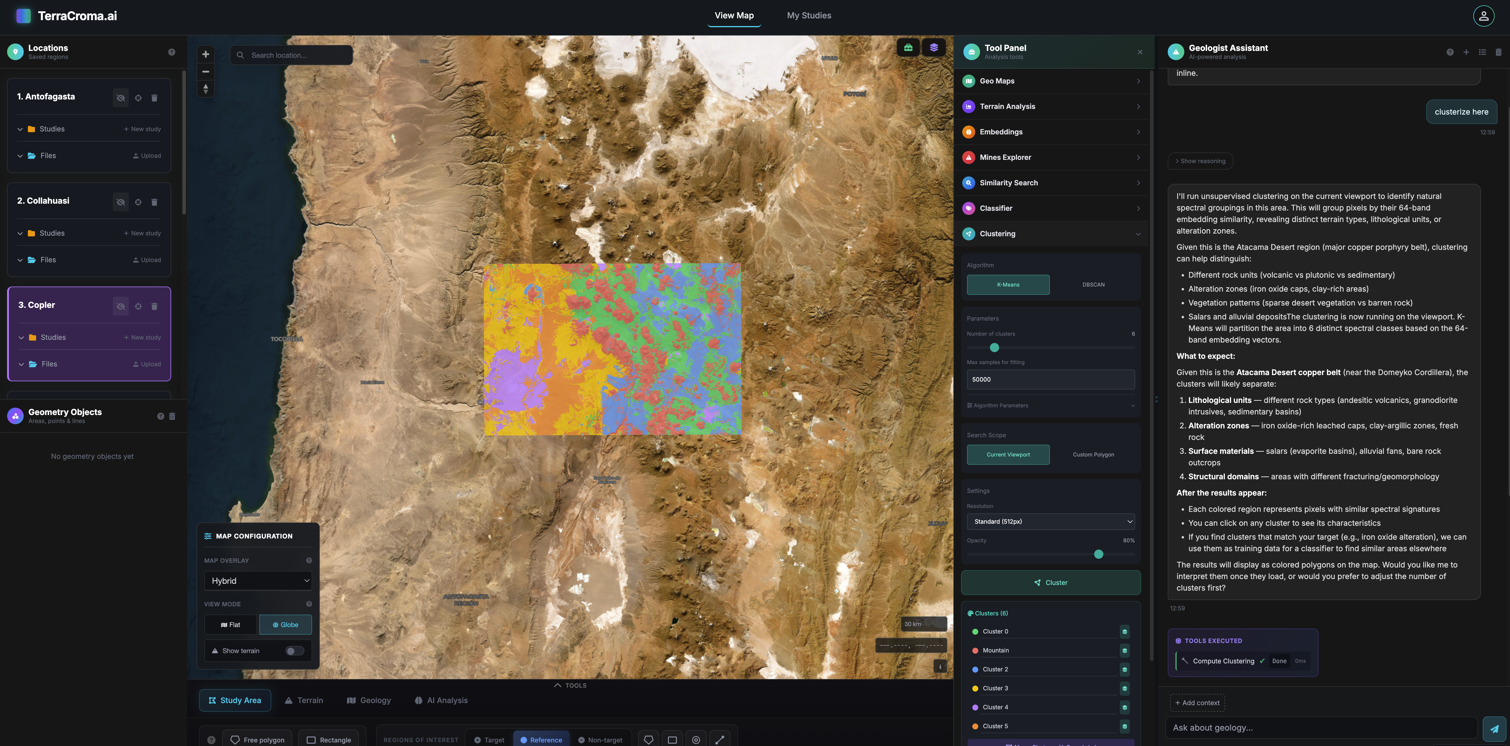
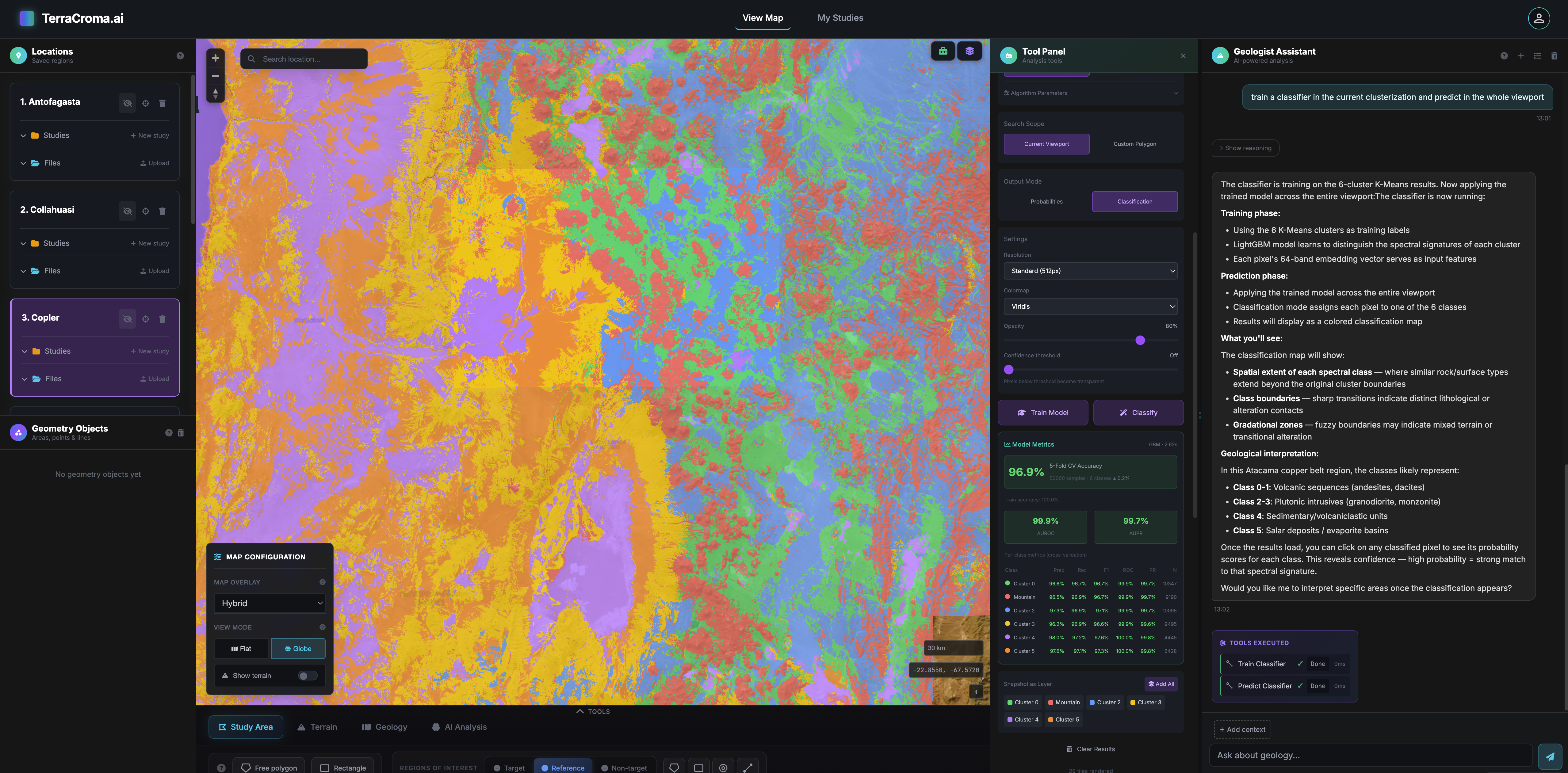
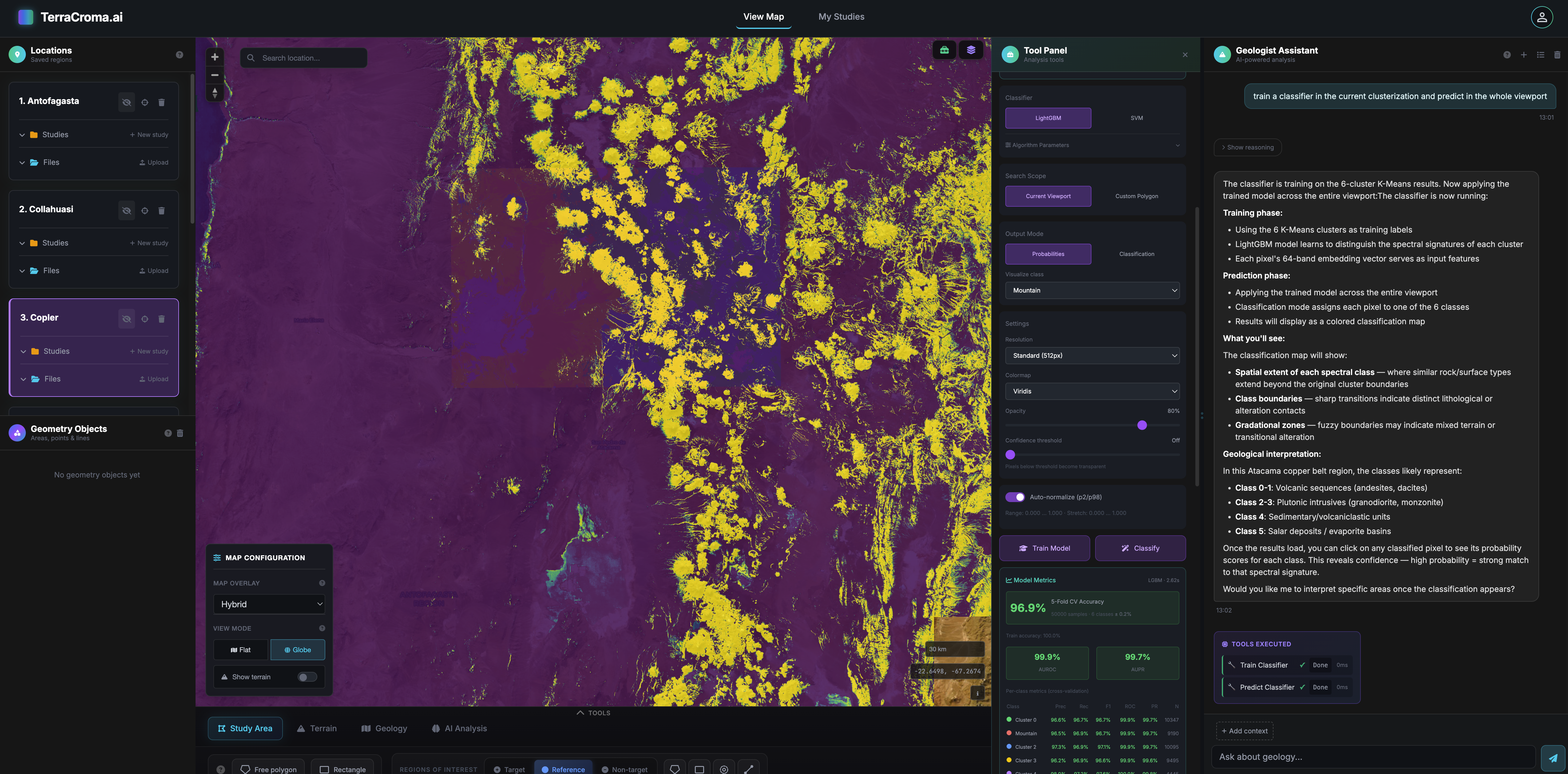
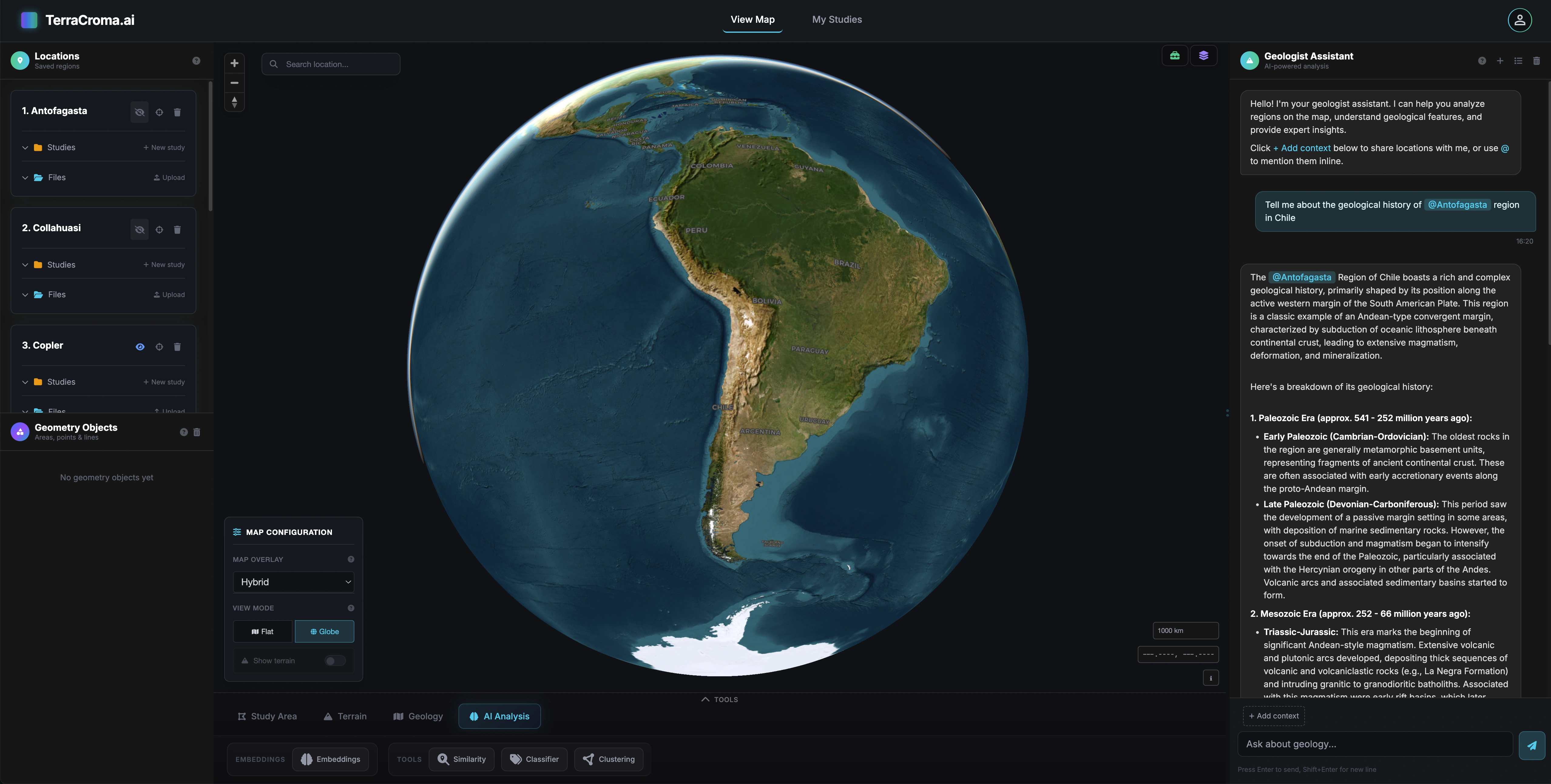
Tell the assistant what you want. It picks the right tools, sets parameters, runs them in the right order, and explains the result — all from a single natural-language prompt.
Example prompt
"Find iron-oxide alteration within 5 km of mapped faults in this district and rank the overlap by area."
User states the goal in plain language — no menu-diving, no manual tool selection.
Assistant decomposes the request, picks the right tools, sets parameters, orders the workflow.
Tools run together, each output flows into the next:
Annotated map with ranked target zones, citations to the data layers used, ready to refine.
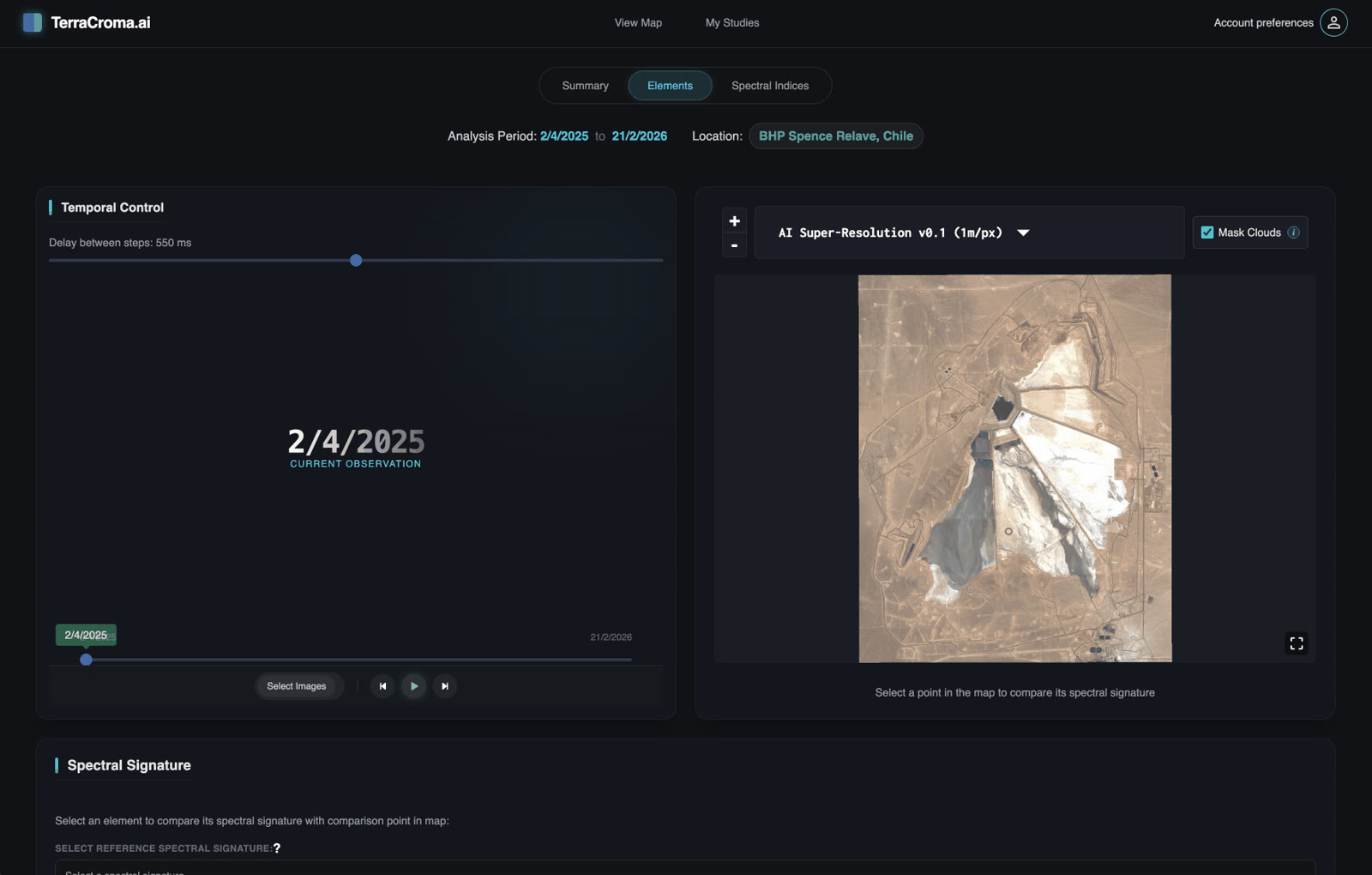
"Show me everywhere this slope has moved more than 3 cm since 2022."
"Compare this outcrop's spectral signature to the rest of the district."
"Alert me whenever a vehicle crosses Zone B outside working hours."
"Search drilling logs for any mention of porphyry-style alteration here."
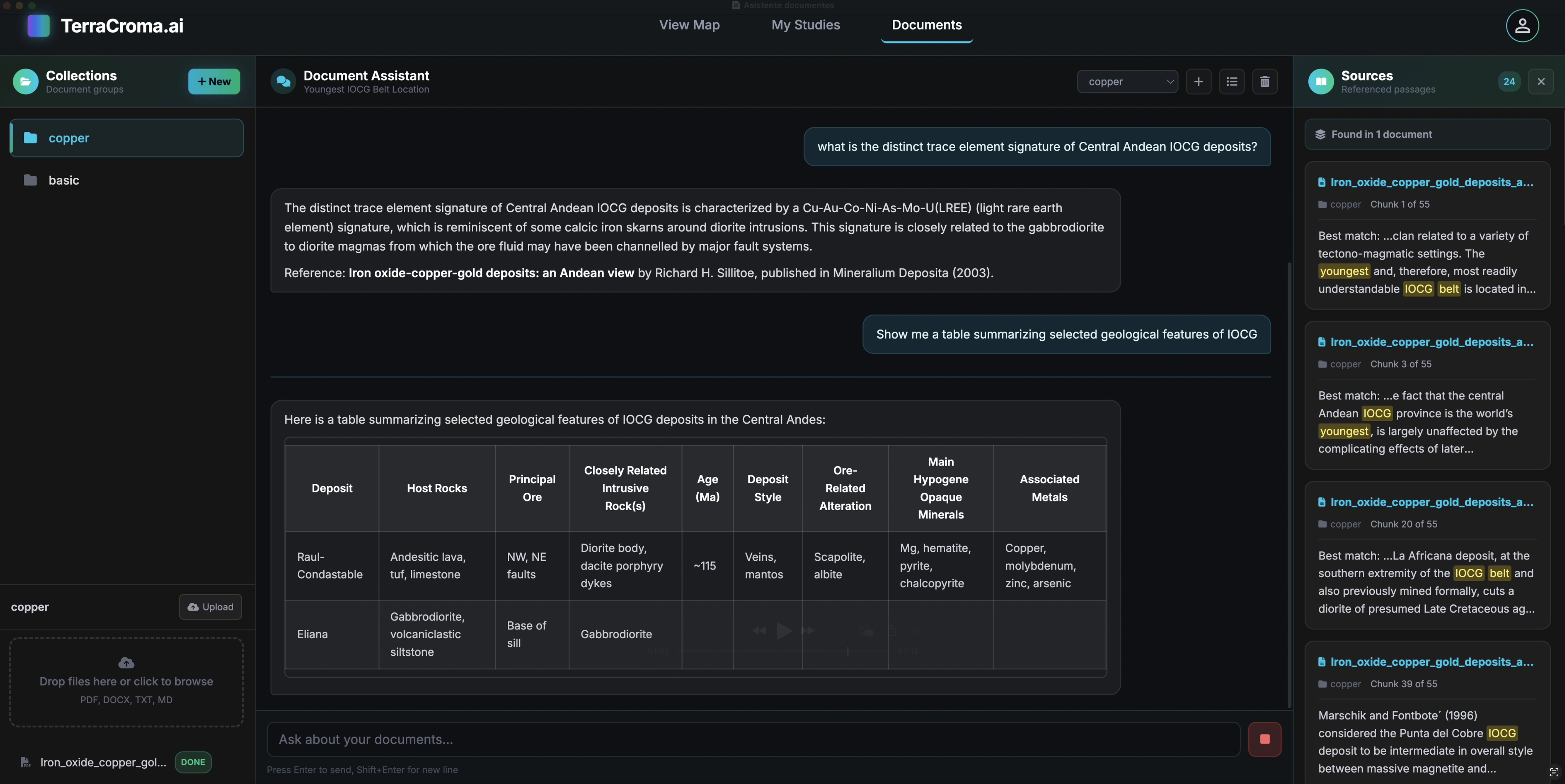
Chat with all your private documents and databases,
on your own infrastructure, with no cloud uploads.
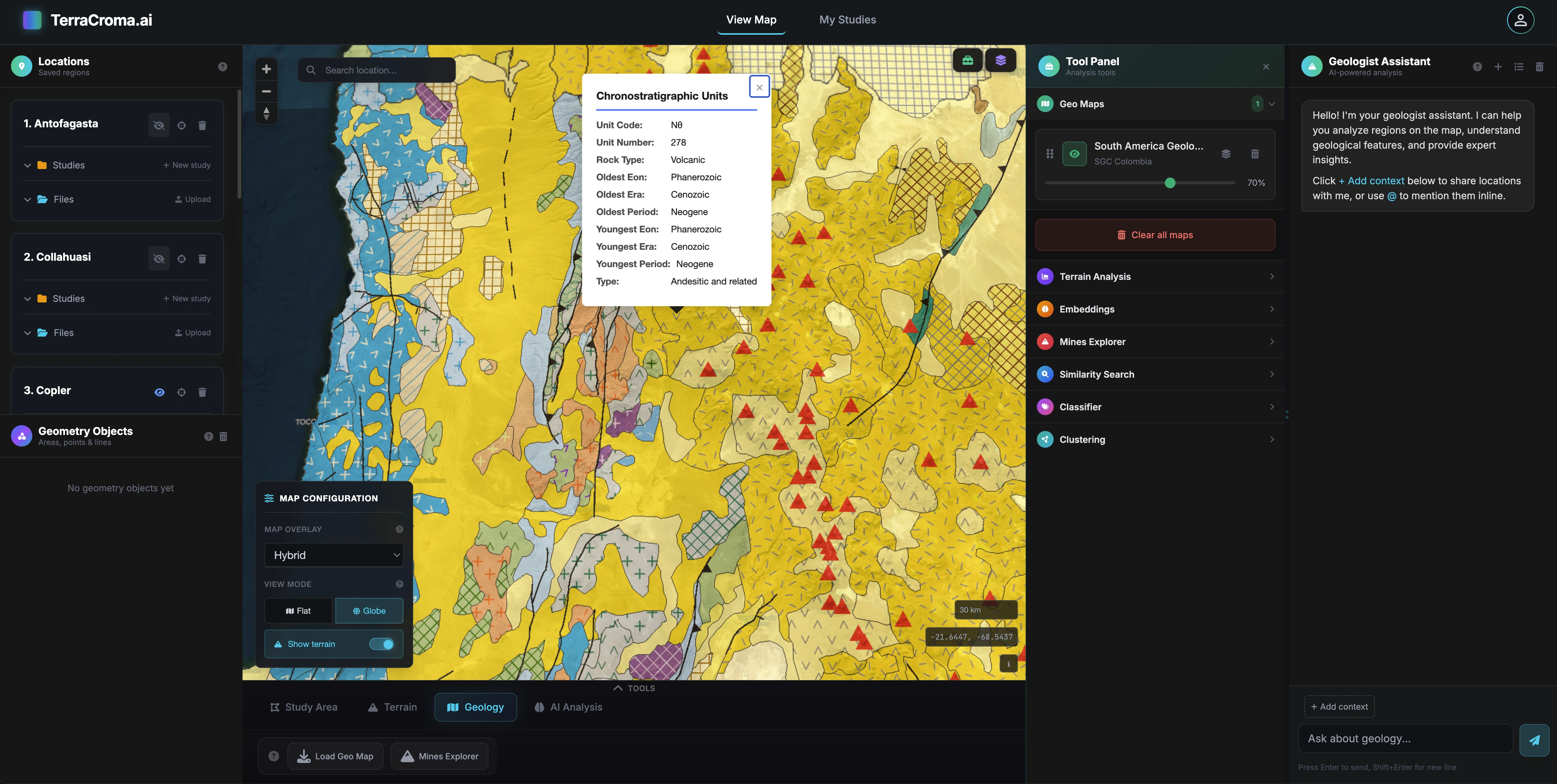
The same assistant that runs the geological workflow, deployed inside your network, can query your private documents and internal databases — geological reports, drilling logs, internal surveys, historical archives and enterprise records — in natural language, with grounded answers and citations.
Your data never leaves your infrastructure. Built for mining enterprises that can't send proprietary exploration data to external APIs. Self-hosted models, per-team access control, full audit trail.
Document Q&A, grounded on your corpus
Ask about any drilling log, report or survey. Answers come back with citations to the source documents.
Local deployment
Self-hosted models. Your servers. Air-gapped option available.
Data sovereignty
Documents never leave your servers. Zero third-party API calls. Per-team access control.
Custom corpus
PDFs, drilling logs, scanned maps & reports: indexed and searchable in natural language.